


For the first episode of FortNine Explore, we're riding along the Saguenay Fjord.
We find an ocean-sized lake, a long waterway framed with perfect off-road terrain and towering sand dunes.
This area is truly an oasis within Quebec's desolate north!
The Route
Download GPS file - Saguenay Motorcycle Trip
The Ride
Jacques Cartier arrives at the Saguenay Fjord. Towering sand dunes and sheer rock faces dare him to enter. He knows the legend.
Cartier’s guides whisper of the “Kingdom of Saguenay.” Their Algonquin songs wail for blond-haired, gold-adorned men: lonesome seafarers who found a familiar home in these northern fjordlands.
Cartier's crew is ready for the New World, but pitifully unprepared to battle an existing Kingdom. He orders them to store every matchlock rifle and blade below deck. One cannot risk meeting these powerful Lords with weapons drawn.
Cartier weighs anchor, swallows hard and sets a course due North. He sails the endless inlet for a full day and night, scanning the fjord walls, always wary of being watched. But as one empty cove follows another, the Frenchmen grow bold. And celebratory. They are the discoverers of this land after all. They are alone.
But the guides are pensive. Their Algonquin tales do not lie. These rock faces have seen ships before. These pine trees have heard European voices.
Le Royaume de Saguenay has come and gone.
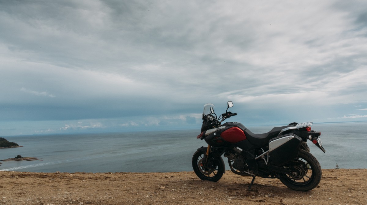
 The Saguenay Fjord is a place of legends - mythical history, famous roads.
Motorcycling to Saguenay
We take the brain-numbing HWY 40 to Trois-Rivières, so my mind wanders to the events of 1535. Was the Kingdom of Saguenay a myth, or Vikings? France searched this area for years without ever discovering the elusive realm. The fjord swallowed ships and sailors alike, but never revealed its secrets.
I can’t go back and see who walked here first, but I'm keen to ride the fjord today – with the same spirit of exploration – and feel the kingdom for myself.
At Trois-Rivières we switch to HWY 155; my daydreams are replaced with stunning reality. The road between Trois-Rivières and Lac Saint-Jean looks unremarkable on a map. Remote - yes. Curvy - perhaps. But stunning? Probably not.
Look closer.
The highway between Shawinigan and La Tuque literally frames the sweeping curves of the Saint-Maurice River. Pavement and water are indistinguishable on my GPS, but they form a perfect pair in real life. Moreover, the road surface is flawless and the traffic is nonexistent.
 Quebec Highway 155 is a riverside road between Shawinigan and La Tuque.
I get to La Tuque shockingly fast. Let’s blame that on the dying battery in my watch…
Anyway, La Tuque is not pretty. Adjectives like “utilitarian” and “small” would be fitting. But not pretty. I utilize this city to stock up on bear bangers and food-hanging rope. Bush camping up north requires more preparation than in Montreal. And this summer chill is a good reminder of how far north we’ve travelled.
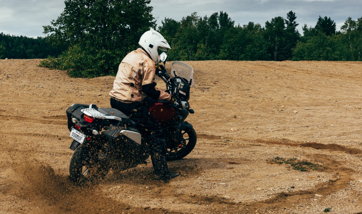
La Tuque is the biggest city in Canada. No, seriously. At over twenty-five thousand square kilometers, it’s larger than the entire country of El Salvador. But almost nobody lives here. Thanks to this magic combination, the city builds long roads without bothering to pave them. I reap the benefit of extensive off-road terrain near Lac Wayagamac.
If La Tuque is an ADV playground, then it’s also a sport rider’s paradise. The concrete is used sparingly but very, very well. Chemin du Lac-Édouard is the best paved road I’ve ever ridden. Full stop. Its undulations and corners are as relentless as a roller coaster.
 Six Flags has nothin' on Chemin du Lac-Édouard.
 Peering over yet another blind hill.
 The end of the road in Lac-Édouard. It's a beautiful little town that won't be found on many maps.
I load up on gasoline before continuing towards Lac Saint-Jean. If you run premium fuel, don’t expect to find any between La Tuque and Chambord.
Day One - First Impressions
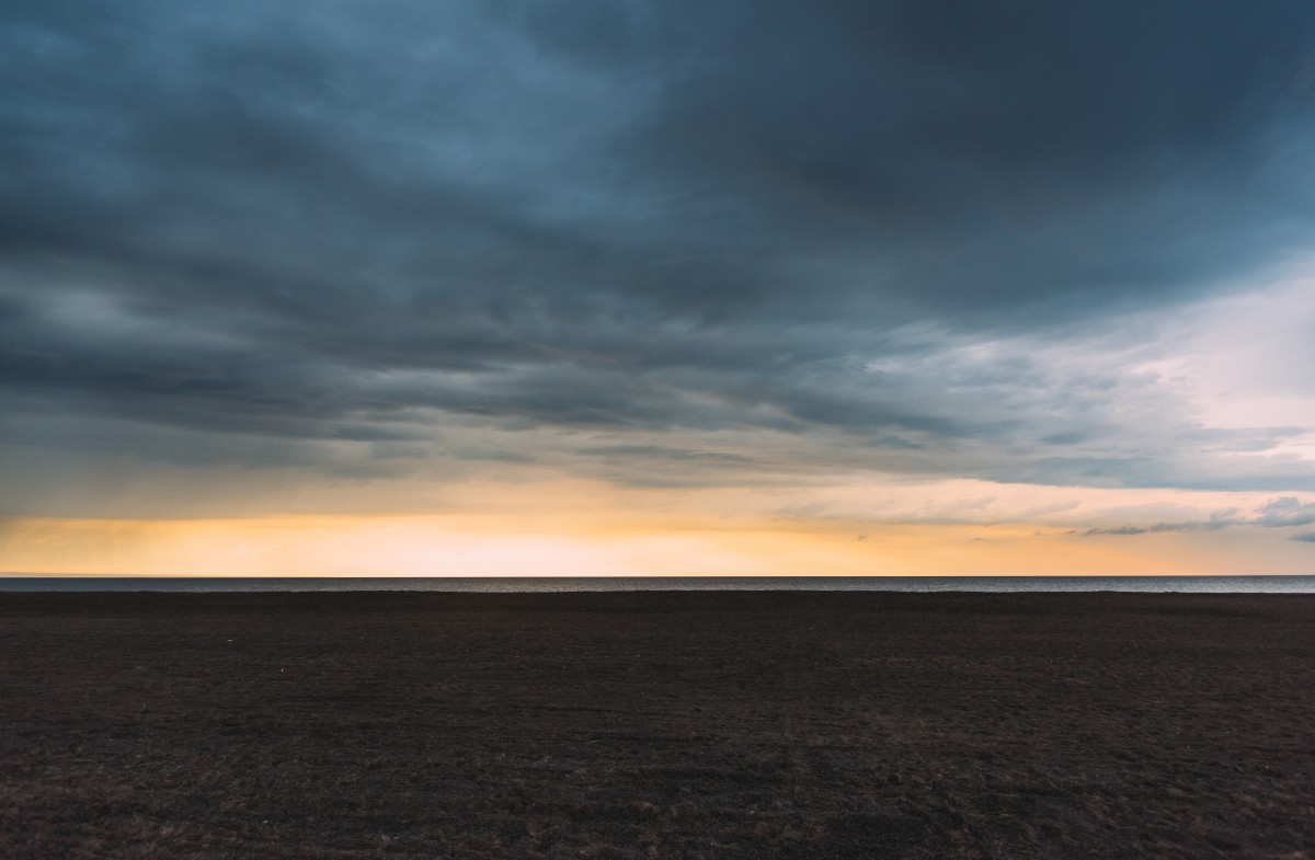
I think that I’ve made a very wrong turn. This isn’t a lake. It’s an ocean.
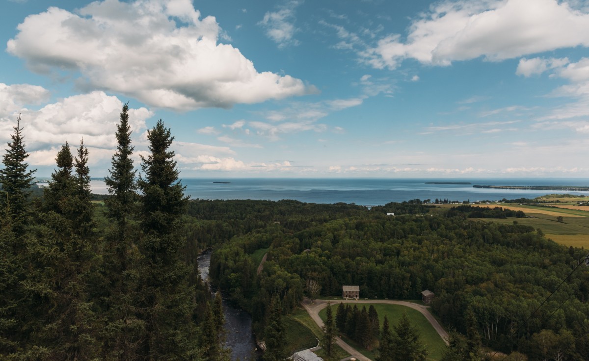 Lac Saint-Jean stretches beyond the horizon, even from up here.
The glacier that carved the Saguenay Fjord settled in Lac Saint-Jean at the end of the last Ice Age. It melted into this enormously wide and shallow body of water – big enough to produce a temperate microclimate and wide tidal beaches. This is my first taste of Saguenay’s royal reputation and it leaves me feeling mighty humble.
 Our skimboarding beach at Club Social Dynamo - the perfect spot to catch a sunset.
We end our day skimboarding across tidal pools. Behind us, the sunset turns storm clouds gold, then amber, orange, red and burgundy. If the ocean-like beach wasn’t so astonishing, we might have noticed when the clouds turned black.
But we didn't.
It rains harder than I ever thought possible. I’m not sure where the lake ends and the rain begins, but I think we’re somewhere in between. Now there’s good news and bad news. And very bad news.
- Good news: My motorcycle gear, in the film car, is totally dry.
- Bad news: There’s no way for me to put the gear on without soaking it through.
- Very bad news: One of our video cameras didn’t enjoy the deluge as much as we did.
So with one camera kaput and no chance of staying dry, we decide to scratch our bush camping plans. Instead, we head to a gas-station-motel combo with a leaky roof.
It feels like the driest place on earth.
Day Two - The Fjord
In the daylight, we realize that our gas-station-motel combo is actually a gas-station-motel-restaurant combo. So, breakfast.
Our waitress is the first Lac Saint-Jean local that I speak to, and it doesn’t go well. Lac Saint-Jean French is different from Montreal’s joual , and both are different from the French French that they teach in high school. I manage to order something for breakfast, but I’m not sure what it is.
After breakfast we hit Val-Jalbert, which is equal parts annoying and enjoyable.
 This waterfall once powered the pulp mill at Val-Jalbert. Today, it's just pretty.
Val-Jalbert is a company town, which was abandoned in 1927 when the pulp mill closed down. So it’s basically a time capsule of that particular era. There is a gorgeous waterfall, some old mill works and plenty of deserted buildings. So far so good.
The problem is, abandoned stuff isn’t exactly rare. Old buildings are a dime a dozen in Quebec; you can normally find them at the end of dirt trails, aging and rotting and begging to be explored. So these roped-off, polished-up showpieces leave a bit to be desired.
That’s not to say Val-Jalbert isn’t cool. It just isn’t special. So when I pay thirty bucks to get in, my money is mainly going towards some live actors (who I’d rather not see), a trolley ride (which I’d rather not go on) and safety barriers (which I’d rather not have).
I think my disappointment in Val-Jalbert is partially due to my own bias. I came here to experience the mysterious history of Vikings and explorers. Other people might have enjoyed a 1920s industrial town, but it misses the mark for me.
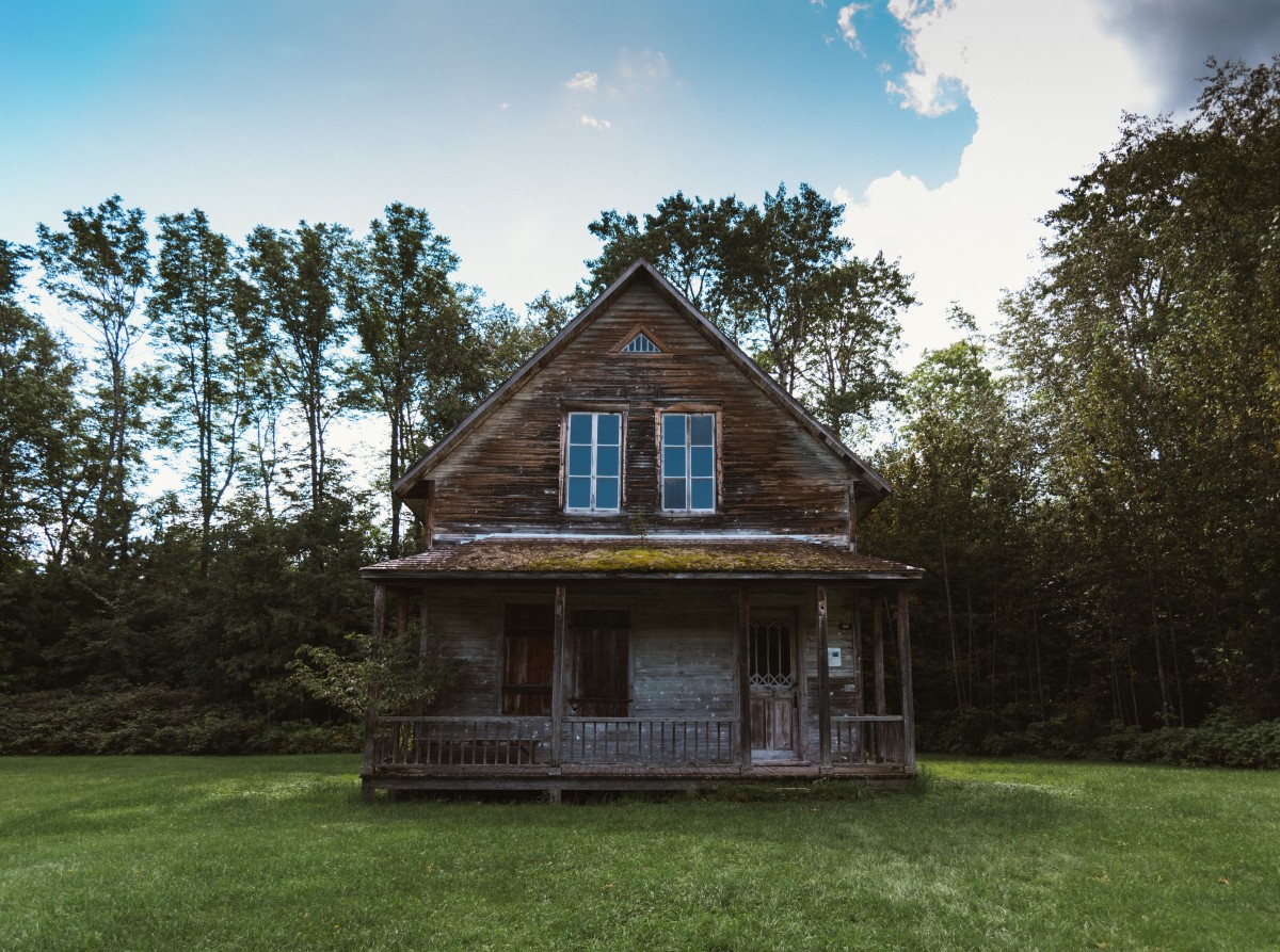 Yeah, it's cool. But my current apartment is older than this house.
We escape the tourist trap and head for Chicoutimi. This marks the start of our journey down the mighty waterway.
Every brochure will tell you that the Saguenay Fjord is “the only navigable fjord in North America.” I’m not sure what the hell this means. I’ve sailed into several British Columbian fjords before and they certainly seemed navigable. Nonetheless, Saguenay’s questionable claim to fame gets me thinking.
How much of the fjord can I “navigate” on a motorcycle?
Fjords are characterized by steep cliffs descending abruptly into water – not the best terrain for two wheels. I know that HWY 170 and HWY 172 will take me down the length of the fjord, but neither will give a clean line of sight to the channel. I check my GPS and see that HWY 170 connects to plenty of back roads. If I can trace the channel from the pavement and descend into various coves and inlets via dirt tracks, I’ll feel like I’ve “navigated” the same fjord that Cartier did. And perhaps, the same fjord that Norsemen sailed long before both of us.
Game on.
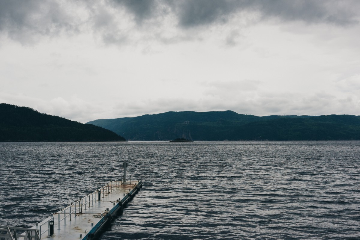
La Baie is easy to get into. Quite literally, I got my tires from the pavement to the water in less than a minute. The next effort, Chemin de l'Anse à la Croix, is closed when we get there. Chemin de l'Anse à Didier is a good alternative, but fails to get us all the way into the bay. Chemin de l'Anse aux Érables is redemption – a fast dirt road that yields an epic fjord view. We finish at Baie Éternité – the best of all. This cove is within the national park, so it doesn't make a challenging ride. But the Government of Canada claimed it for a reason.
 The towering walls of Baie Éternité frame the perfect postcard shot.
We debate stringing a rain tarp over our campsite, but all I can see is stars. After dumping some foil-wrapped potatoes in the fire and flopping a burger on the grill, I sit back and appreciate my surroundings. The glacier-carved rock faces are reminiscent of the Rockies. Only yesterday it felt like we were at the ocean. And tomorrow, our journey will end in the desert.
This is a majestic place indeed.
Day Three - The Dunes
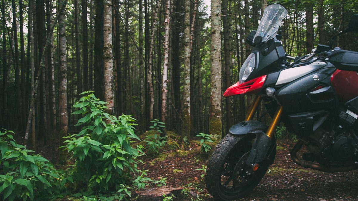 My V-Strom 1000 spent the night in its natural environment - Parc national du Fjord-du-Saguenay.
I wake up and know that it will rain. Something about motorcycle camping makes me hypersensitive to the weather. I can predict the conditions better than a meteorologist with a crystal ball. The unusually dry night, the dew clinging to my tachometer, the humid frigidity in the wind – it will definitely rain before we get back to Montreal tonight.
But there’s work to do before then. I cram my nylon hotel into the side cases and get busy riding the fjord.
After more kilometers on the distant HWY 170, we zip into the waterway via L’Anse-Saint-Jean. Beluga whales crowd into this bay during the summer months, mainly to tease the tourists that crowd into waterside cafés. We don’t see any – tourists or whales – but the town is picturesque enough by itself. Chemin de l’Anse is a fjord-side road worth riding. It also provides a good excuse to go through the famous Faubourg Bridge.
 Are you wealthy enough to recognize this covered bridge from Canada's $1000 bill? Me neither.
 View of the fjord at L'Anse-Saint-Jean. They take the "Royaume" thing seriously around here, having elevated local mayor Denys Tremblay to "King Denys I" in 1997. He abdicated the throne a few years later.
Sometimes I hate being right. The rain hits as I’m leaving L’Anse-Saint-Jean. We’re already behind schedule, so the change in weather only confirms what I expected: we’ll have to skip the next stop. I hoped to explore L'Anse de Saint-Étienne on the final stretch of the Saguenay Fjord. Instead, we use HWY 170 and 138 to sprint to the finish line.
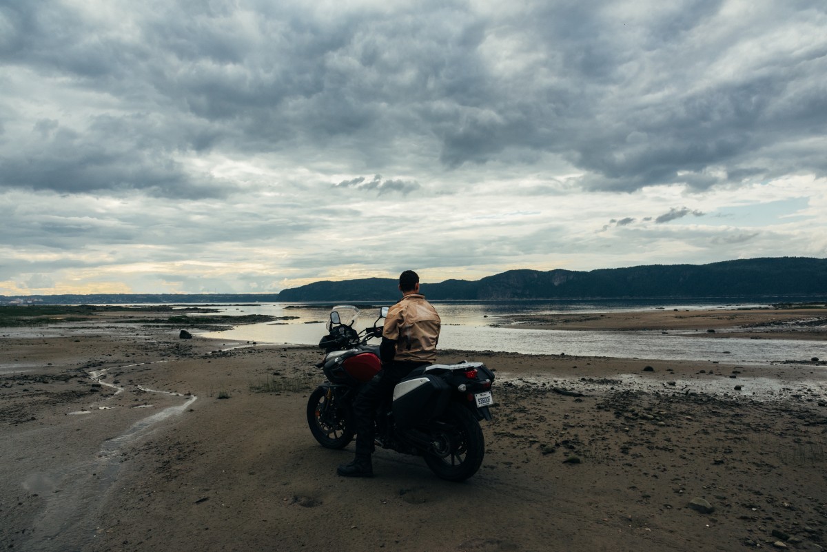
 The V-Strom, having navigated the Saguenay Fjord, reaches the St. Lawrence River at the end of our journey.
Named after the Innu word for "breasts," I expect Tadoussac to be delightful.
It doesn’t disappoint. We take a (free!) ferry into Tadoussac proper and head straight for the dunes. These are some of the largest sand dunes in Canada, with two prominent mounds that look conspicuously similar to … never mind.
The boobs … erm, dunes … descend straight into swirling waters. This is where the Saguenay Fjord empties into the mighty St. Lawrence River. The rippling bands of colour – Lac Saint-Jean blue, St. Lawrence navy, sandy green – mark the end of our journey.
The collision of these currents also churns up krill, which makes Tadoussac yet another whale watching mecca. And just to sound like a broken record, I’ll tell you that we never catch a glimpse of Moby Dick. What I do see, however, is a motocross sandbox. These dunes are scribbled with high-mark tracks. Even with a loaded V-Strom on street tires, I can’t resist seeing how I measure up.
Not well, as it turns out.
The Strom is all roost and no speed. I make it 6 inches up the incline before the back tire sinks, leaving a rather embarrassing low-mark. I may not have seen any whales, but I feel like I’m wrestling one now. When I finally get the Strom un-stuck, I play around on the flatter terrain. If you don’t mind getting shown up by kids on 80cc dirt bikes, it’s not a bad way to spend the afternoon.
 Doughnuts are a great way to hide the fact that you can't get any traction.
 The Tadoussac sand dunes are a popular destination for summer skiers.
Our second shooter, Neil, puts on a much better show. He’s been dragging around a pair of downhill skis the entire trip and I’m beginning to see the wisdom in it. Neil carves the sand as if it were snow. The sight garners applause from some of our fellow beachgoers. I secretly hope that he trips in my low-mark.
After a hearty sidecase meal of stale croissants, we head for home.
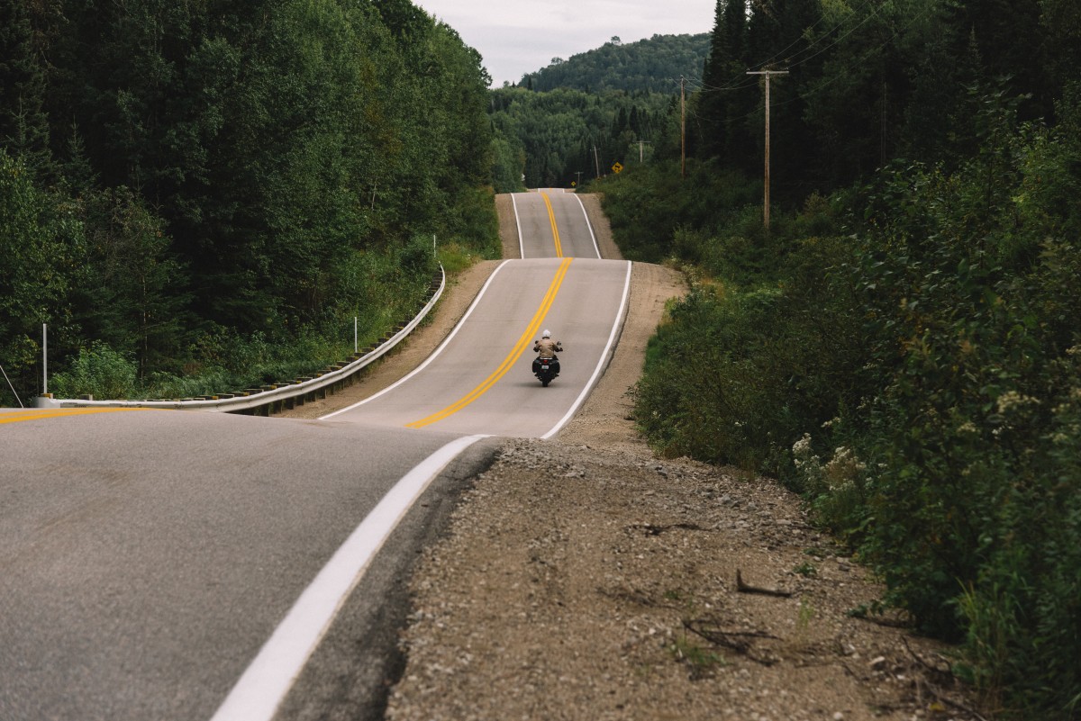
On the way back, I find HWY 138 to Quebec City surprisingly fun. It follows the natural curve of the St. Lawrence, which isn’t the twistiest of rivers. My optimistic foot peg reaches down at every corner without ever touching home. All the same, speed limits are blissfully high and the views are fresh.
In contrast, HWY 20 between Quebec City and Montreal is hypnotically efficient. I catch myself daydreaming yet again. Did Vikings rule the fjord, long before Cartier arrived? Or is the Kingdom a myth after all?
Remembering the majestic beauty we discovered, I decide to let the Fjord keep its secrets. No matter what the history is, Saguenay’s royal reputation is well-deserved.
 My goal was to ride along Saguenay's legendary waterway. Mission Accomplished.
 The long ride home, with plenty of memories to look back on.
Tips for Motorcycling in Saguenay
- Bring something to do on the sand dunes – Obviously, motorcycling is high on the to-do list. Anything on knobbies can have a blast in here. Skis and snowboards are also advisable. Swimsuits and picnic baskets provide more relaxing options.
- Ride the fjord – You can’t say you’ve “ridden” Saguenay until you trace the fjord from top to bottom. If you fancy dirt riding, HWY 170 offers better off-road excursions into the channel. Pavement pounders will prefer HWY 172 for its better road quality and quieter traffic. Don’t miss Sainte-Rose-du-Nord if you ride the north side.
- Try the red champagne – The specialty beverage of Saguenay-Lac-Saint-Jean is somewhere between Red Bull and Nectar. If you like it, be sure to buy a case. This soft drink is hard to find anywhere else.
- Watch your gas – If you take HWY 155 in, beware that there are no major gas stations between La Tuque and Chambord.
- Keep your eyes open - the Saguenay Fjord is a great place for spotting whales. So we're told, at least...
- Hike Sentier de la Statue in Baie Éternité – We didn’t have time for this three-hour hike. But if we did, the view would have been spectacular.
- Allow plenty of time – I could have spent two days in Baie Éternité. Plus another two in Lac-Saint-Jean and one in Tadoussac. Add a day for exploring dirt roads, and we’re getting close to a week-long trip.
- Skip Val-Jalbert – The area’s #1 tourist attraction is way, way down on my list.
- Pack warm – Lac Saint-Jean is further north than I thought. Even in the middle of summer, I was layering underneath my motorcycle jacket every day. Long sleeves and pants have the added benefit of thwarting the herculean mosquitos.